FOSS4G Europe (Free and Open Source Software for Geospatial Europe) is Europe's leading conference in the field of open-source geospatial technology.
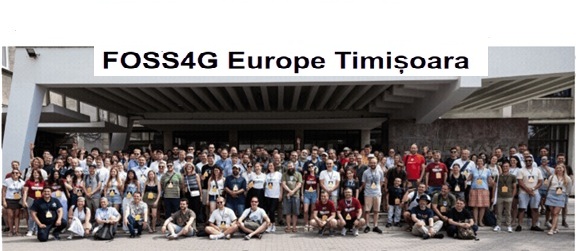
As you can see in the photo, every year it brings together a large group of developers, researchers, government agencies, and companies working on projects such as QGIS, PostGIS, GeoServer, GDAL, and many other open-source solutions. On behalf of Geo-ICT Training Center, I attended the conference to further deepen my technical knowledge, network within the community, and lead a workshop on building an open-source IoT geospatial pipeline. However, FOSS4G is about more than just technology.
The conference is taking place at a time when Europe is increasingly focusing on the discussion of digital sovereignty and the role that open-source software can play in reducing dependence on proprietary platforms. This broader context gave many of the discussions during the conference added significance and relevance.
Digital sovereignty begins with digitally independent infrastructure. Europe is increasingly recognizing the risks of over-reliance on proprietary software. For example, the U.S. CLOUD Act can require U.S. companies to grant access to data, even when it is stored on European servers.
Due to the changing geopolitical situation, Europe is becoming increasingly aware of this dependence and is seeking ways to reduce it, for example:
The Dutch government has announced stricter rules for the use of cloud services by the national government².
With the QGIS Application Management course, we demonstrate that it is entirely possible to make the switch and free yourself from exorbitantly expensive so-called vendor locks.
Other countries, such as France, are also taking steps to reduce their dependence on non-European digital solutions¹.
Against this backdrop, open source is more important than ever. FOSS4G brings together the open-source community focused on geoinformation software.
The relevance of this conference is growing, but the open-source model also raises an important question: if the software is free and open source, how do we ensure its long-term sustainability?
Modern IT systems rely heavily on open-source software, yet many of the people who maintain this software are not directly paid for their work.
If we want this community to continue to grow and innovate, we will need to support it—for example, through financial contributions or by actively participating in software projects and events.
My First FOSS4G Europe
The trip was an experience in itself. Together with Hans van der Kwast, Dirk Voets, and Laura Agudelo Mayorga, I traveled to Romania by train. Just as the heat wave in the Netherlands was coming to an end, it was beginning in Romania. We experienced both, with temperatures there reaching about 40 degrees Celsius. That made the trip quite intense, but it also gave us plenty of time to spend together before the conference even began.
This was my first FOSS4G Europe, and I went there primarily to learn as much as possible on a technical level and to lead a workshop. I learned a lot about various open-source systems and how they work together. From the outside, you often see individual applications or projects, but during the conference I gained a much better understanding of how all these parts together form a larger ecosystem, with many different components that fit together.
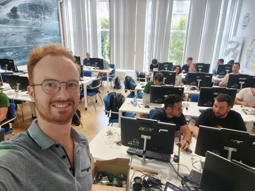
Joram and workshop participants during the session: “From Sensor to GeoJSON: Building an Open-Source IoT Geo-Pipeline”
One of the things I enjoyed most was meeting the people who actually build the software. If you’re a fan of a particular open-source project, a conference like this gives you the chance to meet the core developers, attend their workshops, and learn directly from them. It felt like a privilege to walk among so many experts and engineers with such a vast amount of knowledge. There’s an incredible amount of expertise at a conference like FOSS4G, and it was special to be a part of it.
At the same time, the conference didn’t feel formal or distant at all. I met many passionate people, and conversations quickly went beyond just a first introduction because everyone shared the same interest and enthusiasm for the field. You could dive right into in-depth discussions while building new connections. That gave the community the feeling of one big family. And just like in any family, there are also discussions and challenges, but that’s exactly what makes it all part of the experience.
It was good to see that there was also room for these kinds of conversations during the conference. One example was the discussion about AI in open source: how can artificial intelligence be used to contribute code, and when does it actually cause problems? These aren’t simple issues, but it’s important that the community has the space to discuss them openly with one another.
I not only learned a lot during the sessions and workshops, but also from Hans, Dirk, and Laura, and from the many spontaneous conversations during lunch and dinner. Those informal moments were just as valuable. The conference gave me a much clearer picture of the open-source geospatial ecosystem and of the enormous amount of knowledge, collaboration, and dedication required to keep it running.
Internet of Things Workshop
At Geo-ICT Training Center, we are actively strengthening our commitment to open source. At this year’s FOSS4G Europe, we put that ambition into practice by hosting a workshop. Just like all our courses at Geo-ICT, this workshop was hands-on and open-ended: we provided participants with the basics, after which they were given the freedom to further develop their own ideas.
In the workshop
In the geoinformatics world, we usually start with an existing dataset. But what if you want to collect your own data? In that case, you can use a sensor and send the results to a database. The good news is that building your first project is surprisingly simple—if you know where to start.
The participants were introduced to the entire architecture behind sensor data. During the workshop, we built a sensor and sent the data via Wi-Fi to a backend. One of the advantages of open source is that different building blocks can work together seamlessly when they use open standards. This also allows you to store and use the data in your own database.
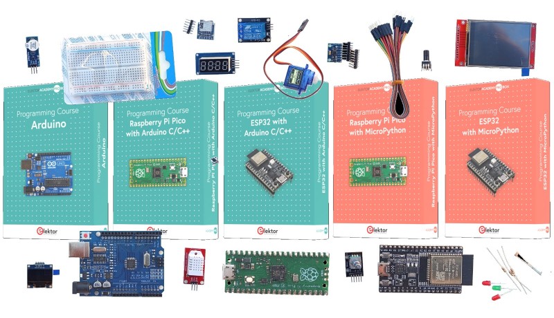
We started off slowly with an introduction to all the hardware components. Next, we built a blinking LED (the hardware version of “Hello World!”). The end result was a temperature and humidity sensor connected to a microcontroller with a GPS antenna.
It was a lot of fun to lead a hardware workshop and see how much enthusiasm it generated. Through conversations with Hans van der Kwast, I came to appreciate the value of self-directed learning, and I applied that approach in the workshop. This allowed participants to work at their own pace. Some recreated the Romanian flag using LEDs, while others improved my code or helped each other with the configuration. Everyone worked in the same room and helped each other when needed. As an instructor, it sometimes feels like you’re not adding much when you’re not speaking. Yet a large part of the learning process actually takes place when participants discover solutions on their own. A personal learning goal of mine is therefore to keep quiet more often and give that process room to unfold.
From Sensor to Dashboard
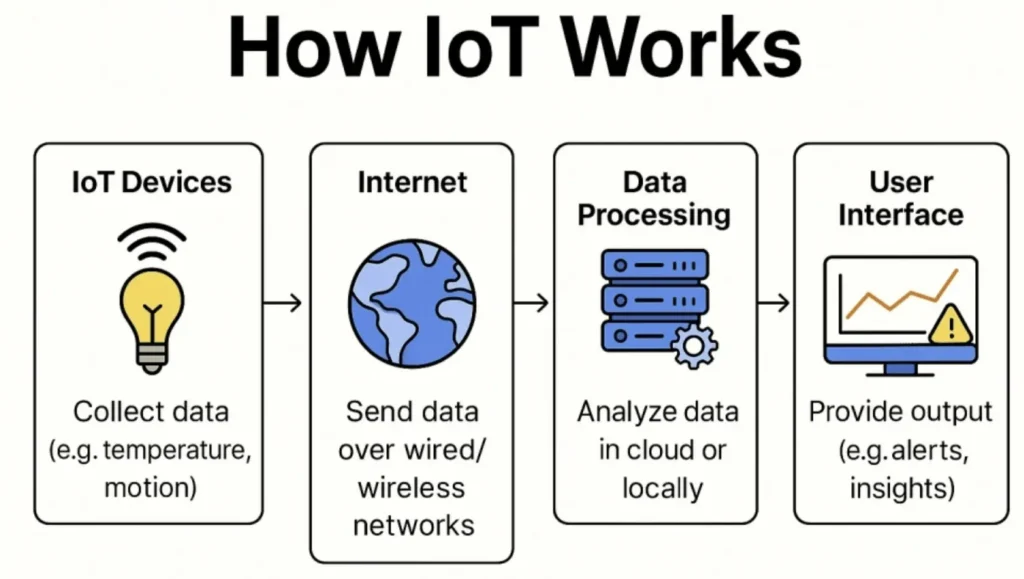
The architecture in the image above goes beyond a single sensor. It shows how a complete open-source Internet of Things pipeline connects the sensor, backend, and dashboard. The workshop at FOSS4G offered a sneak peek at our new course, “From Sensor to Map with C++ and XIAO ESP32-C3.” The Blink instructions later in this blog post are an even smaller teaser: they cover only the first step of what participants will build during the full course.
This course is part of a broader series of Geo-ICT courses that cover the various components of an open-source IoT pipeline:
The two “From Sensor to Map” courses cover a similar process but use different technologies. The course using the XIAO ESP32-C3 uses C++ and takes a more production-oriented approach. The course using the Arduino Nano ESP32 uses MicroPython, making it more accessible to beginners.
Each course can be taken separately, but together they provide the knowledge needed to build a complete open-source pipeline: from a physical sensor to a backend and a web-based dashboard. This allows you to collect, process, and store your own data in your own environment, and ultimately turn it into an application that can actually be used.
During this course, you’ll work with a GPS module, a temperature and humidity sensor, and standards-compliant data exchange via the OGC SensorThings API, among other things.
Lessons Learned for Geo-ICT
One of the biggest insights I’ve gained is a much better understanding of the open-source geospatial ecosystem. I’ve come to appreciateevenmore the enormous amount of collaboration, coordination, and long-term commitment required to develop and maintain the software that so many organizations rely on every day.
At Geo-ICT, we already work extensively with open-source technologies and provide training on many of these tools. Attending FOSS4G reaffirmed just how valuable this ecosystem is, not only for software development but also for knowledge sharing and collaboration. The conference gave us new ideas on how we can further expand our expertise, integrate more of the broader open-source ecosystem into our training courses, and continue to actively contribute to the community.
FOSS4G Europe (Free and Open Source Software for Geospatial Europe) is the largest European conference on open-source geospatial technology. Developers, researchers, government agencies, and companies come together here to share knowledge about projects such as QGIS, PostGIS, GeoServer, and GDAL, and to collaborate on the future of open-source GIS.
Digital sovereignty means that organizations retain control over their own data, infrastructure, and software. By using open-source solutions, governments and businesses can reduce their dependence on proprietary software and determine for themselves where and how their data is stored and processed.
An open-source IoT pipeline connects a sensor to a backend, database, and dashboard. Sensors collect data, which is transmitted, stored, and visualized using open standards. This allows you to fully determine how you collect, process, and use sensor data, without relying on proprietary platforms.
Open standards ensure that different hardware and software components can work together seamlessly. The workshop held during FOSS4G Europe made use of, among other things, the OGC SensorThings API, which enables sensor data to be exchanged in a standardized way between sensors, databases, and GIS applications.
Geo-ICT views open source not only as software, but also as a way to share knowledge and foster collaboration. By actively participating in events such as FOSS4G Europe, organizing workshops, and offering training courses in areas including QGIS, IoT, and open-source web technologies, Geo-ICT contributes to the further development of the open-source geo-ecosystem.
Search the website
Find courses, MOOC content, articles and more in one place.

 Joram and workshop participants during the session: “From Sensor to GeoJSON: Building an Open-Source IoT Geo-Pipeline”