When I founded the Geo-ICT Training Center years ago, I noticed that there was a lot of talk about the future of the field, but relatively little was actually happening. I was convinced that we’d be better off stopping the endless talk and meetings and just getting to work. A field that’s primarily preoccupied with itself doesn’t grow.
Geo-ICT and geoinformation are applied in virtually all sectors: from water management and infrastructure to agriculture, energy, mobility, and the built environment. It’s a growing market.
That’s why I started with something very practical: a website offering over sixty CAD and GIS courses. Not because I thought CAD and GIS constituted the entire field, but because that’s where the greatest need lay at the time, and we could immediately help professionals advance their skills.
In this blog, I’ll take you through the six foundations of the Geo-ICT field and show you why these disciplines, in particular, form the foundation for every modern Geo-ICT professional.
That practical approach has never changed. For me, Geo-ICT is the application of information and communication technology to collect, process, analyze, and ultimately apply geographic information.
Whether it involves surveying, drones, satellites, GIS, GeoAI, or digital twins, the goal is always the same: we use geographic information to make better decisions.
Precisely because Geo-ICT is such a broad field, professionals from a wide range of academic backgrounds enter the field. For example, our trainees have studied earth sciences, geography, civil engineering, the built environment, environmental science, hydrology, or another geo-related discipline. During their studies, they have often already become familiar with one or more of the field’s fundamentals. This allows us to teach them relatively quickly the practical skills needed to work with GIS, CAD, and other Geo-ICT technologies. They are then immediately ready to work for our clients.
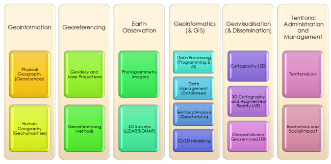
Behind every map, analysis, or digital twin lies a solid foundation of geosciences and technical disciplines. A recent article by the International Federation of Surveyors (FIG) describes this foundation based on six fundamental pillars of geomatics. Although the name of the field is open to debate, I particularly endorse the idea behind it: a good Geo-ICT professional understands not only the software but also the disciplines upon which that software is built.
Twenty years ago, when people thought of Geo-ICT, they often thought of a GIS application on a desktop computer. Today, that picture has completely changed. Geographic information is not only analyzed, but also continuously collected, processed, shared, and applied. Virtually every technological development now has a spatial component.
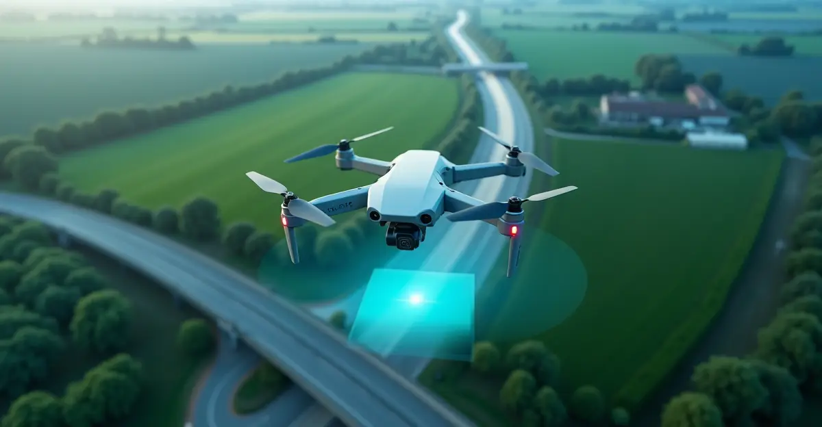
Drones and LiDAR make it possible to quickly create highly detailed 3D models of the physical environment. Satellites provide new images of the Earth every day, while IoT sensors and GNSS equipment continuously collect up-to-date data on, for example, traffic, water levels, air quality, and infrastructure. Thanks to cloud platforms, these enormous amounts of data can be processed and shared almost instantly. Artificial intelligence (AI) then helps identify patterns, automatically classify objects, and make predictions. All this information ultimately comes together in dashboards, webGIS solutions, and, increasingly, in digital twins.
These developments are driving the continued expansion of Geo-ICT. The field not only impacts the traditional geo-sector but now plays a key role in areas such as the energy transition, climate adaptation, agriculture, mobility, water management, asset management, and construction.
This is precisely why it’s clear that Geo-ICT is much more than just GIS. Behind every map, analysis, or digital twin lies a chain of disciplines. Data must first be collected, accurately georeferenced, processed, analyzed, visualized, and ultimately applied. Those who see only the end product miss the bigger picture.
That bigger picture is nicely summarized in a model from the International Federation of Surveyors (FIG), in which the geospatial field is composed of six fundamental disciplines. Together, they form the foundation for every modern Geo-ICT professional.
Geo-ICT is evolving at breakneck speed. New technologies such as GeoAI, digital twins, IoT, and cloud platforms are changing the way we work, but they all build on the same foundation.
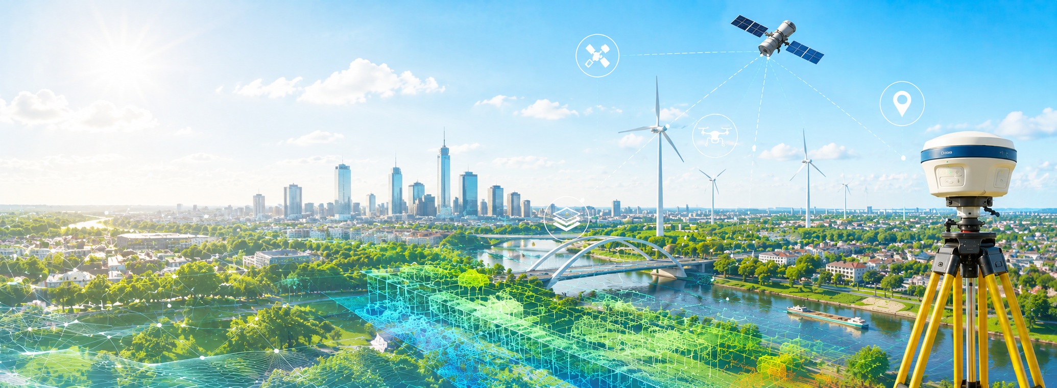
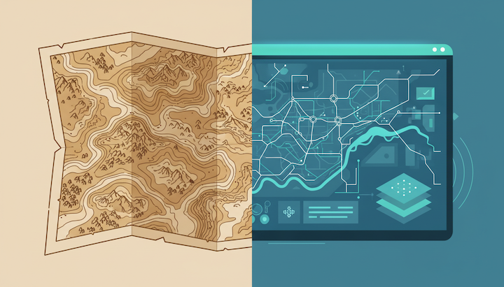
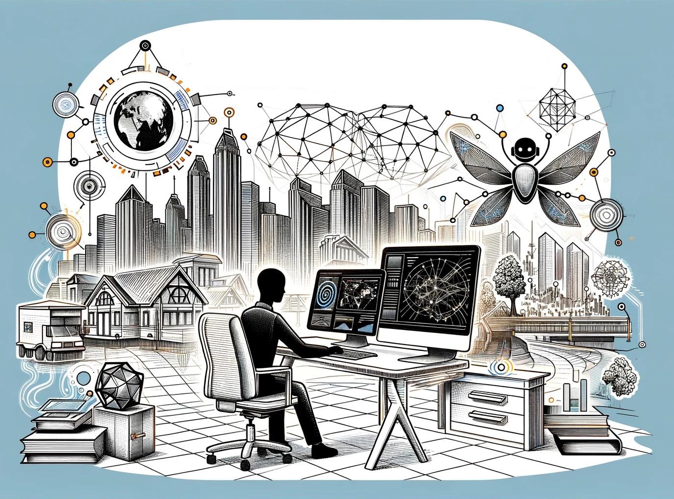
That foundation consists of six fundamental disciplines: Georeferencing, Earth Observation, Geoinformatics, Geo-visualization, Land Management, and Geo-information (see the image at the top of this blog). Together, they describe the entire chain of the geospatial field: from collecting geographic data and accurately determining locations to analyzing, visualizing, and managing that information.
It is precisely because these disciplines work together that Geo-ICT has grown into a field applied in virtually every sector. In the following sections, I will discuss each of these fundamentals and show how they collectively form the foundation for every modern Geo-ICT professional.
It 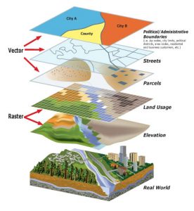 all starts with geoinformation. Before you can collect or analyze data, you need to understand what you actually want to describe. That requires knowledge of physical and human geography—such as landscape, soil, water, infrastructure, and built-up areas—and how these elements are interconnected.
It is precisely this substantive knowledge that distinguishes someone who can operate a GIS program from a Geo-ICT professional who understands spatial issues. After all, a map is never the goal, but rather a tool for gaining insight into reality.
Our trainees often come from academic backgrounds such as earth sciences, geography, hydrology, or the built environment. There, they lay the foundation for understanding geographic processes. That knowledge serves as the starting point for the rest of their development within Geo-ICT.
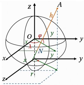 Geographic data is only valuable if the location is accurate. Georeferencing, therefore, revolves around accurately determining positions on Earth. This is where the field has its roots, encompassing disciplines such as geodesy, surveying, GNSS, total stations, and coordinate systems.
Although many professionals use GPS on a daily basis, few people realize how much technology is required to determine a position with an accuracy of just a few centimeters. Without that accuracy, maps, digital twins, and spatial analyses would simply not be reliable.
New developments such as autonomous driving, precision agriculture, and machine control are also entirely dependent on this fundamental knowledge.
In the blog “Geodetic Supply Chain,” you can read that this foundation is of vital importance and should be high on the agenda of world leaders.
 Whereas in the past much of the data was collected manually, today a large portion of geographic information is gathered automatically. Satellites, drones, LiDAR, photogrammetry, and real-time sensors provide enormous amounts of new data every day.
These technologies make it possible to visualize changes almost immediately. Examples include land subsidence, flooding, vegetation growth, infrastructure, and the progress of construction projects.
The amount of available data continues to grow exponentially. As a result, the challenge is shifting increasingly from collecting data to processing and interpreting it intelligently.
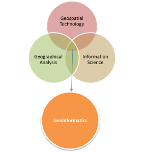 Geoinformatics is perhaps the best-known component of Geo-ICT. This is where geographic data is stored, managed, analyzed, and combined. GIS plays a central role in this, but databases, Python, SQL, FME, cloud platforms, and—increasingly—GeoAI are also part of this foundation.
It is precisely within this discipline that the other foundational elements come together. Data from drones, GNSS, satellites, and sensors is transformed here into actionable information that enables organizations to make better decisions.
GeoAI further accelerates this development. Whereas analyses used to be performed entirely by hand, algorithms can now recognize objects, detect changes, and make predictions. Nevertheless, the quality of the results always depends on the quality of the underlying geographic data.
Good analyses are only valuable when people understand the results. Geo-visualization translates complex datasets into maps, dashboards, 3D models, and digital twins that provide immediate insight.
This is important because more and more decisions are being made based on geographic information. Executives, policymakers, project leaders, and administrators don’t want to see the raw data; they want a clear picture of the situation.
With the rise of webGIS, interactive dashboards, and digital twins, visualization is also becoming increasingly important—not only for analysis, but also for communication and collaboration across different disciplines.
Ultimately, Geo-ICT is not about data, but about managing and developing our living environment. Land Management focuses on recording, managing, and using geographic information within organizations and government agencies.
Think of basic registries, property information, asset management, land-use planning, cables and pipelines, water management, and public spaces. This is where all the previous foundations come together, and analyses are translated into practical applications.
That is precisely why Geo-ICT has become indispensable today. Virtually every societal challenge—from housing construction and the energy transition to climate adaptation and mobility—requires reliable geographic information and professionals who understand how the entire geospatial chain works.
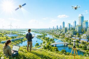 If there’s one trend I see, it’s that Geo-ICT will only become more important in the coming years. Virtually every societal challenge now has a geographic component. Think of the energy transition, climate adaptation, housing construction, mobility, water management, and the design of our living environment. At the same time, GeoAI, digital twins, cloud platforms, and real-time sensor data are ensuring that geographic information is available more quickly and plays an increasingly important role in decision-making.
Technology will continue to evolve in this regard. In ten years, we’ll likely be working with tools we can barely imagine today. But no matter how quickly technology develops, the fundamentals of the profession will remain the same. Those who understand how geographic information is collected, georeferenced, analyzed, visualized, and managed will be able to continue adapting to new developments.
That is also the vision with which I originally founded the Geo-ICT Training Center—not by endlessly debating definitions, but by training people and advancing the field. We still apply that vision today. Our courses and traineeships are based on real-world practice and the broad foundations of Geo-ICT, enabling professionals to become quickly deployable while simultaneously developing a solid foundation for their future careers.
This approach has proven successful not only in the Netherlands. We are now increasingly applying the same formula in other European countries as well. The challenges may vary from country to country, but the fundamentals of Geo-ICT remain the same everywhere. That is precisely why I believe that knowledge sharing, practice-oriented training, and international collaboration will play a key role in the further development of our field.
If we continue to invest in people and in those six foundations, I am convinced that the future of Geo-ICT has only just begun.