
The "Spatial Data Science with QGIS" course covers the integration of advanced spatial analysis methods and data science techniques within the open-source QGIS environment.
Artificial Intelligence
The "Spatial Data Science with QGIS" course covers the integration of advanced spatial analysis methods and data science techniques within the open-source QGIS environment.
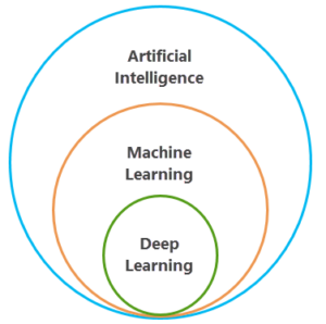 Spatial Data Science is an essential discipline within the field of geoinformation. It involves analyzing and interpreting geographic data to reveal patterns, trends, and relationships within a spatial context. This field combines the principles of data science with advanced geospatial analysis methods. It utilizes machine learning and geostatistics to solve complex problems. By integrating these techniques into platforms such as QGIS, users can gain in-depth insights into geospatial datasets and create predictive models. This is crucial for decision-making across various sectors.
In our course “Spatial Data Science with QGIS,” you’ll dive into the world of advanced spatial analysis and data science. You’ll learn how to approach and solve complex geospatial problems using geostatistics, spatial modeling, and machine learning. These techniques will enable you to uncover hidden spatial patterns, build predictive models, and perform advanced analyses. The focus is on developing the skills to effectively communicate the results of your analyses. This will enable you to support data-driven decision-making.
Geo-ICT emphasizes the practical application of data science techniques to real geospatial datasets. This enables participants to gain not only theoretical knowledge but also hands-on experience applying these techniques in practice. The course is designed to familiarize participants with the QGIS platform. This is a leading geographic information system that offers extensive tools for spatial analysis and data visualization.
The applications of spatial data science are broad and diverse, ranging from environmental management and urban planning to logistics and emergency response. By developing the skills to perform advanced spatial analyses, you’ll open the door to a world of possibilities where you can make a significant impact using geoinformation.
For beginners in QGIS, we highly recommend the QGIS basics course.
Spatial data science is the intersection where advanced analytical techniques and geospatial technologies meet. The goal is to uncover valuable insights from geospatial data. This discipline uses data science techniques such as machine learning, geostatistics, and spatial modeling to analyze and solve complex spatial problems. But what makes it so unique and essential?
Unlike traditional data science, spatial data science takes into account the spatial dimension of data. This makes it possible to identify patterns, trends, and relationships that are only visible when geographical context is considered. This can range from predicting weather patterns and managing urban development to optimizing logistics routes and improving emergency response strategies.
That’s why our course, “Spatial Data Science with QGIS,” is specifically designed to deepen your understanding of this powerful discipline. You’ll learn not only how to collect and analyze geospatial data but also how to transform this data into actionable insights using the QGIS platform. This platform offers a rich set of tools for advanced spatial analysis, data visualization, and building predictive models. This allows you to fully harness the power of spatial data science.
By taking this course, you’ll enter a world where geodata is seen not just as a collection of points, lines, and polygons, but as a key to unlocking deeper insights into our world. It’s an adventure that will take your skills to a new level, enabling you to better understand and navigate the complexity of the world around us.
In short, with Geo-ICT, you’ll not only learn the theory but also gain the practical experience needed to become an expert in spatial data science.
In the world of spatial data science, geostatistics and machine learning play a crucial role in analyzing and interpreting geodata. These two methods form the backbone of advanced spatial analyses. They enable scientists, researchers, and professionals to uncover insights that would otherwise remain hidden. Let’s take a closer look at how these techniques are applied in the “Spatial Data Science with QGIS” course and the value they offer:
By mastering geostatistics and machine learning, you’ll unlock the full potential of geospatial analysis. You’ll also open up new opportunities for innovation and discovery within your field. Geo-ICT ensures that you not only learn the theory but also gain practical experience through hands-on exercises and projects. This way, you’ll not only become familiar with the tools and techniques but also learn how to apply them in real-world scenarios.
Within the field of Spatial Data Science, advanced spatial analysis methods open new doors to understanding and solving complex geospatial problems. These methods, which are central to this course, enable you to go beyond basic analysis and draw deeper, more insightful conclusions from geodata. Let’s explore some of these advanced techniques that you’ll learn to master:
By applying these advanced methods within QGIS, you can:
Mastering advanced spatial analysis methods within QGIS means you have the skills to transform geoinformation into valuable insights and solutions. This knowledge and experience will set you apart in the field of spatial data science and prepare you for future challenges within the geoinformation sector.
The integration of machine learning into QGIS offers unprecedented opportunities for analyzing and interpreting geodata. This powerful combination enables you to perform advanced analyses and develop predictive models that shed new light on spatial issues. Our course “Spatial Data Science with QGIS” places a strong emphasis on the practical application of machine learning within this platform. Here are some ways you’ll use machine learning:
What makes these applications special in QGIS is their user-friendliness and accessibility for professionals of all skill levels. You don’t need to be an expert in programming to use these advanced machine learning tools. Geo-ICT ensures that, through hands-on exercises, you will:
The practical application of machine learning in QGIS gives you the ability to transform geospatial information into actionable knowledge. This opens new doors for solving complex problems and creating value across various sectors—from environmental management to public safety.
If you want to explore the world of Spatial Data Science with QGIS, there’s no better place to start than at Geo-ICT. Here are a few reasons why our course is the right choice for you:
Choosing our “Spatial Data Science with QGIS” course means choosing a program that not only enhances your skills but also prepares you for the future challenges in the geoinformation sector. Whether you’re a beginner or looking to expand your existing knowledge, our course provides you with the tools, techniques, and network you need to succeed in the exciting world of spatial data science.

Need help?
Contact usOn the first day of the course, the focus is on understanding the basic principles of spatial analysis and data science within the QGIS platform. The day begins with an overview of the advanced analysis tools available in QGIS and how they can be applied to geospatial datasets. Students will learn about geostatistical techniques, such as kriging and point pattern analysis, to understand and model spatial variability.
In the afternoon, basic concepts of machine learning and data science will be introduced, including concepts such as classification, regression, and clustering. Students gain insight into how these techniques can be used to identify spatial patterns and build predictive models. Hands-on exercises enable students to explore data and perform simple analyses using QGIS tools.
On the second day of the course, students delve deeper into advanced spatial analysis and data science techniques. The morning begins with a more in-depth exploration of machine learning algorithms specifically suited for geospatial data, such as decision trees and spatial regression. Participants learn how to apply these algorithms to complex datasets and how to evaluate the results.
In the afternoon, the course covers spatial visualization techniques to effectively communicate the results of analyses. Students will learn how to design maps that visually represent spatial patterns and predictions. The course concludes with practical case studies, in which students are challenged to perform advanced spatial analyses and data science applications on complex real-world datasets.
By the end of the course, students will have a thorough understanding of the advanced capabilities of spatial analysis and data science within QGIS. They will be able to address complex geospatial issues using advanced techniques and effectively communicate the results.
Do you have questions about the course content? Or are you unsure whether the course aligns with your learning goals or preferences? Would you prefer an in-house or private course? We’d be happy to help.
This course is designed for professionals and (advanced) beginners in QGIS who want to go beyond the basics of QGIS to explore the analysis of geodata and determine whether recurring patterns can be identified within the data.
A solid foundation in QGIS is recommended. Prior knowledge of machine learning and statistics is helpful, but the course covers the necessary fundamentals.
Spatial Data Science with QGIS
focuses on advanced statistics, spatial modeling, and classical machine learning techniques (such as clustering, regression, and kriging) within QGIS
Deep Learning with QGIS:
Focuses specifically on neural networks, image classification, object detection, and segmentation using Deep Learning models (GeoAI) in QGIS
Spatial Data Science: Suitable for analyzing spatial patterns and trends using statistics and ML models, such as predictive models, cluster analysis, interpolation, and geostatistics
Deep Learning: Ideal for automatic recognition of objects (such as buildings, roads, vegetation), detecting changes, and segmentation in aerial or satellite imagery.
