course
The Power of 3D GIS
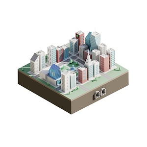
3D GIS technology transforms the way we interpret and present spatial data by providing a rich, three-dimensional context. It enables us to better understand and visualize the complexity of the physical world, from urban planning and landscape management to archaeology and emergency response. With tools like QGIS 3, you can create elevation models, city models, and more, creating an interactive experience that is both informative and engaging. This technology opens new doors for data analysis and decision-making by offering a deeper insight into the geographic context.
Applications of 3D GIS
3D GIS is used in a wide range of fields, from urban planning to environmental management. By creating detailed, three-dimensional visualizations, professionals can understand and interpret complex datasets, enabling better decision-making. In urban planning projects, for example, it helps visualize the impact of new developments, from sunlight and shadows to sightlines. For environmental management, it offers valuable insights into terrain and water systems, which is essential for conservation and planning.
What will you learn in the QGIS 3D Visualizations Course?
Management and Visualization of 3D Data
Effectively managing and visualizing 3D data is crucial in the world of GIS. The QGIS 3D Visualization Course provides in-depth knowledge and skills for working with advanced 3D data in QGIS. This course focuses on collecting, managing, and dynamically visualizing data such as LiDAR and digital terrain models, enabling participants to approach complex geographic analyses visually and make decisions with a better understanding of geoinformation.
Practical Applications with QGIS
The QGIS 3D Visualization Course offers in-depth insights into how to effectively create 3D models and visualizations with QGIS. This course explores the practical applications of QGIS, from creating realistic city and terrain models to analyzing geographic data in a three-dimensional context. It focuses on the integration of LiDAR data and digital terrain models, which are essential for accurate elevation and terrain analysis. These skills are particularly valuable in urban planning, environmental management, and other fields where in-depth spatial insight is required.
Why choose our QGIS 3D Visualization Course?
Choosing our QGIS 3D Visualization Course means choosing a learning experience that is not only theoretically grounded but also practical and immediately applicable. Our course stands out because of:
- Expert Instructors: Our instructors are not only experts in their field but also have a passion for sharing their knowledge, making learning both engaging and effective.
- Hands-On Lessons: We believe in learning by doing. That’s why our course is designed with a strong focus on practical applications, allowing you to get started with the software right away.
- Small Groups: We keep our classes small to ensure personal attention and a better learning experience.
- Access to the Latest Technologies: Students gain access to the most recent QGIS software and receive guidance on using the latest tools and techniques in 3D GIS.
By choosing our course, you’re investing in a valuable skill that’s widely applicable across various fields of geoinformation and geodata. Not only will you become proficient in using QGIS 3 for 3D visualizations, but you’ll also strengthen your position in the job market with this specialized knowledge.