Google Earth Engine ChatGPT

Google

Google

Learn how to turn satellite imagery into actionable insights using Google Earth Engine, enhanced by the simplicity of ChatGPT. In this hands-on course, you’ll explore how to analyze and visualize geospatial data using natural language—no coding required. Whether you're working in environmental science, urban planning, or just curious about Earth observation, this course gives you the tools to make smarter, data-driven decisions.

Course duration: 1 day

Taught by:

Elizaveta Khazieva
English

Introduction to Geospatial Technologies

Geo-ICT Training Center, The Netherlands - Google Earth Engine ChatGPT

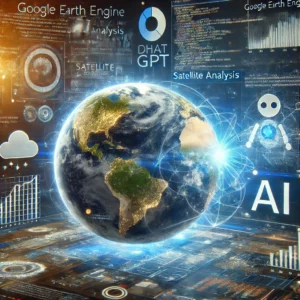
Google Earth Engine (GEE) is a cloud-based platform that enables the processing of massive geospatial datasets—particularly satellite imagery—with remarkable speed and scale. It gives users access to global image archives and analytical tools that were once limited to large research institutions or governments.

What makes GEE transformative is its ability to quickly perform spatial analyses over time and space. From tracking deforestation and urban sprawl to monitoring drought conditions or vegetation changes, it allows anyone to process and visualize data that reflects real-world dynamics on Earth.

ChatGPT, developed by OpenAI, introduces a new layer of accessibility by letting users interact with this geospatial data using natural language. Instead of writing lines of code, users can ask complex questions—like “Where has vegetation declined over the last five years in this region?”—and receive intelligent, contextual responses that trigger real data analyses in the background.

Together, GEE and ChatGPT democratize advanced geospatial analytics. Whether you’re working in environmental science, urban development, disaster response, or land management, this combination of tools allows you to make data-driven decisions faster, more clearly, and more collaboratively than ever before.

In this course, you’ll learn how to harness both platforms to transform raw satellite imagery into meaningful insights—without needing to be a programmer.

What will you learn

Working with satellite data might seem complex, but this course makes it easy, fast, and practical. You’ll learn how to combine Google Earth Engine with the power of ChatGPT to explore and analyze environmental data—using simple language instead of code.

From the start, you’ll learn how to:

  • Access and filter satellite imagery using Google Earth Engine
  • Use ChatGPT to guide your workflow by asking natural language questions
  • Classify land cover, detect vegetation change, and monitor environmental trends
  • Visualize results through clear maps and graphics

Whether you’re an environmental researcher, a city planner, a student, or just curious about geospatial tech, this course gives you real, ready-to-use skills in just one day. You’ll work with real satellite data, solve realistic challenges, and build a repeatable workflow you can use again and again.

By the end, you’ll know how to transform raw Earth observation data into powerful, decision-ready insights—no programming experience needed.

Why choose this course

At Geo-ICT, we believe in learning by doing. Our approach is hands-on, relevant, and focused on the real problems you face in the field. Whether you’re a beginner or a working professional, this course helps you build the skills to use today’s most advanced geospatial tools with confidence.

Here’s why learners love this course:

  • It combines AI and satellite data for fast, intuitive analysis
  • You’ll use real datasets to explore real-world issues
  • It’s designed for non-programmers—no coding required
  • The skills you gain are useful across industries and disciplines

Sign up


    Group Discounts:
    10% for 3 participants
    15% for 4 or more participants


    Prices are indicative and may vary by country. Feel free to reach out — we’ll gladly work with you to find a suitable arrangement.

    €895,- Excl. btw

    €895,- Excl. btw

    Course structure

    Day 1

    You’ll start by getting familiar with ChatGPT—how it works, and what makes it useful for natural language processing. Then, you’ll dive into Google Earth Engine: learning how to explore satellite datasets, create visualizations, and run basic analyses.

    From there, you’ll see how ChatGPT can be used to enhance your workflow—helping with image classification, vegetation change detection, and more—just by typing simple questions.

    Course duration: 1 day
    Schrijf mij in

    Learning Outcomes

    By the end of this course, you’ll be able to:

    • Understand how ChatGPT and Google Earth Engine work together for geospatial analysis
    • Ask natural language questions to process satellite imagery and spatial data
    • Detect changes in land cover, vegetation, and environmental conditions
    • Run real-world analyses in a cloud-based, no-code environment
    • Turn raw Earth observation data into clear, shareable visual insights
    • Apply your new skills to practical projects in conservation, planning, climate science, and more

    More Information?

    Do you have questions about the course content? Not sure if the course aligns with your learning objectives? Or would you prefer a private session or in-company training? We’re happy to assist—feel free to get in touch.

    Frequently Asked Questions about Google Earth Engine ChatGPT

    Google Earth Engine is a cloud-based platform developed by Google that allows users to access, process, and analyze vast amounts of geospatial data, such as satellite imagery and remote sensing data. It is widely used for environmental monitoring, land cover classification, deforestation detection, and climate change research. The platform provides powerful tools for running large-scale geospatial analyses and machine learning algorithms, making it accessible for professionals, researchers, and developers to solve complex environmental challenges and develop interactive visualizations.

    In this course, you will learn how to use Google Earth Engine for geospatial analyses, including satellite image processing and image classification, and how to integrate ChatGPT for advanced data analysis.

    This course covers the integration of ChatGPT with Google Earth Engine, including the use of natural language processing to perform geospatial analyses and interpret results.

    For this course, basic knowledge of programming and geospatial concepts is recommended, but beginners with a strong interest in geo-information technology can also participate.

    Absolutely, this course is well-suited for career switchers considering a transition to the geospatial sector. We provide the necessary foundations to get started in geo-information technology.

    During the course, you will work on hands-on projects, such as analyzing vegetation change and land-use planning using satellite images, to apply the theory in practice.

    This course supports your career in the geospatial sector by equipping you with advanced skills in geospatial data analysis, satellite imagery processing, and machine learning applications using Google Earth Engine. You’ll gain practical experience with real-world projects and learn how to integrate ChatGPT for enhanced data interpretation. These skills are in high demand in industries such as environmental monitoring, urban planning, agriculture, and GIS, increasing your employability and career advancement opportunities in the geospatial field.