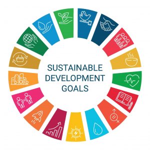
In today’s world, where the need for sustainable development is becoming increasingly urgent, geo-information plays a crucial role. Sustainable development, as defined by the UN Brundtland Commission in 1987, is development that meets the needs of the present without compromising the ability of future generations to meet their own needs. Geoinformation and technologies enable us to better understand and manage our planet and its complex systems. Sustainable Development Goals (SDGs) are directly dependent on our ability to collect, analyze, and visualize data about our environment. In particular, SDG 15.3 on sustainable land management and SDG 15.5 on biodiversity conservation
Through the power of advanced visualization techniques and geospatial data processing, Google Earth Engine offers unprecedented opportunities for air quality monitoring, time-series analysis, and contributions to policy-relevant research. These tools and methods are essential for managing natural resources, monitoring environmental changes, and supporting sustainable policymaking.
In this course, you’ll dive deep into the world of geoinformation, learn how to process and visualize data with Google Earth Engine, and discover how these skills can be applied to contribute to the Sustainable Development Goals. We’ll guide you through the fundamentals of geospatial data analysis—from image collections to reducers and how to use them for effective data visualization and analysis.
You will not only learn about the technical aspects of geospatial information, but you will also discover how this technology can be used to make a positive impact on our world. By participating in this course at Geo-ICT, you contribute to a future where technology and information serve a more sustainable planet.
What is Geo-Data?
Geo-data, simply put, is data with a geographic component. Any piece of information that can be localized on Earth falls under this term. This can range from coordinates indicating the location of a forest fire to the distribution of various species of flora and fauna across different continents. In the context of sustainable development and the Google Earth Engine SDG Course, this data focuses specifically on information that can help us better manage and protect the Earth.
The beauty of geo-data lies in its ability to make “invisible” patterns visible. For example, how land use changes over time, or how air quality varies across different urban and rural areas. By using Google Earth Engine, we can process and analyze massive datasets of satellite imagery and other geospatial data. This enables us to tackle complex issues surrounding sustainability.
One of the key aspects you’ll learn in this course is how to effectively use this geospatial data for sustainable land management and biodiversity conservation. You’ll work with image collections, learn how reducers function to synthesize data, and explore advanced visualization techniques. All of this will enhance your skills in monitoring environmental changes and supporting sustainable policymaking.
Geo-data is not only crucial for scientists and policymakers. It is also a powerful tool for anyone interested in understanding and improving our interaction with the world. By delving into the world of geoinformation in this course, you’ll take an important step toward becoming an active contributor to a more sustainable future. You won’t just learn about the technical side of geodata; you’ll also discover how to apply this knowledge to bring about positive change in the world.
The Role of Geo-Data in Sustainable Development Goals (SDGs)
The Sustainable Development Goals (SDGs) represent a universal call to action to end poverty, protect the planet, and ensure that all people enjoy peace and prosperity. Geo-data plays an indispensable role in achieving these goals—namely, by giving us insight into where we need to take action and by measuring the impact of those actions.
Take, for example, SDG 15.3 on sustainable land management and SDG 15.5 on the conservation of biodiversity. Without accurate geo-information, efforts to halt land degradation and conserve biodiversity would largely be like shooting in the dark. By leveraging advanced technologies such as Google Earth Engine, we can track and analyze changes in land use, species distribution, and the health of our ecosystems on an unprecedented scale.
In the Google Earth Engine SDG Course, you’ll learn how to use this powerful tool to collect and analyze geo-data for projects that directly contribute to achieving the SDGs. This isn’t just a technical skill. It’s a way to contribute to some of the most urgent challenges of our time.
By using image collections, reducers, and advanced visualization techniques, you’ll not only gain the ability to conduct in-depth research on environmental changes, but you’ll also be able to evaluate the effects of human activity on nature and provide policymakers with the information they need to make informed decisions. All of this positions geo-data as a crucial pillar in the pursuit of a more sustainable world.
The role of geo-information extends far beyond the academic and scientific community. It touches on the core of how we, as a society, understand our planet and how we shape our interaction with it for future generations.
What You’ll Learn in the Google Earth Engine SDG Course
Basic Knowledge and Prerequisites
Before you get started with the Google Earth Engine SDG Course, it’s important to know what basic knowledge and prerequisites you’ll need. This course is designed to guide you through the world of geoinformation and sustainable development from start to finish. However, a little prior knowledge can help you get the most out of your learning experience.
First of all, some experience with or knowledge of GIS is an advantage. If you’re already familiar with basic GIS concepts or have used programs like QGIS, you’ll find that many principles overlap or complement each other. This doesn’t mean you need to be an expert; a basic understanding will smooth out your learning curve.
Another useful skill is a basic understanding of programming. Google Earth Engine uses JavaScript for data processing and analysis, so some familiarity with this or a similar programming language will be very beneficial. Again, you don’t need to be an advanced programmer. The course is designed to guide you through the necessary steps.
As for prior knowledge, it’s helpful to have a general understanding of the SDGs and why they’re important for our planet. This will help you appreciate the impact and significance of your work with Google Earth Engine.
Finally, a curious mind and a willingness to learn are the most valuable “requirements.” In this course, you’ll discover how geospatial data can be used to tackle real-world problems and make a difference in the world. You’ll be encouraged to think critically and ask questions. And above all, to be enthusiastic about exploring the possibilities of geospatial information.
Geospatial Data Processing and Visualization
One of the most exciting aspects of this course is the in-depth dive into geospatial data processing and visualization. These skills are crucial for anyone interested in analyzing geospatial information and creating meaningful, impactful projects that contribute to sustainable development.
During the course, you’ll discover how to use image collections. This is a powerful feature of Google Earth Engine that allows you to search and analyze large collections of satellite imagery. This enables you to track changes in the landscape, vegetation cover, water sources, and much more over time.
You’ll also learn to work with reducers, an essential tool for synthesizing and summarizing large datasets. Reducers can be used to calculate averages, medians, or other statistical metrics across a specific area. This makes complex data understandable and manageable.
Another important part of the course is learning to apply advanced visualization techniques. Visualization is more than just making maps; it’s about telling stories with data. You’ll learn how to create effective, informative visualizations that communicate the findings of your analysis to a wide audience—from scientists and policymakers to the general public.
These skills will not only enable you to understand the current state of our planet, but also to predict future trends and propose solutions to environmental problems. By processing and visualizing geodata, you contribute to creating a deeper understanding of how our world is changing and how we can influence these changes in favor of a more sustainable future.
Applications of Google Earth Engine
Google Earth Engine is a revolutionary platform that offers unprecedented possibilities in the field of geospatial data processing and visualization. With its powerful analysis functions and extensive datasets, it offers a range of applications that are invaluable to scientists, policymakers, and anyone committed to sustainable development. In this course, you will learn how this tool can be used for a variety of purposes, ranging from air quality monitoring to promoting sustainable land management and biodiversity conservation.
One of the most exciting applications is the ability to perform time-series analyses. This allows us to monitor changes in the landscape, such as deforestation or urbanization, over a specific period. By visualizing these changes, we can better understand how human activities impact the natural world and how we can take action to mitigate these effects.
In addition, Google Earth Engine offers advanced tools for data visualization. You’ll learn how to transform complex geospatial datasets into clear, understandable visuals. These visuals are not only important for scientific research but also for conveying key information to the general public and policymakers. Well-designed visuals can be a powerful tool for raising awareness and driving change.
Furthermore, Google Earth Engine is ideally suited for policy-relevant research. By combining detailed data analysis with advanced visualization techniques, you can contribute to research that has direct implications for policy-making in the fields of the environment and sustainability.
Using Google Earth Engine in your projects and research not only offers the opportunity to contribute to achieving the Sustainable Development Goals, but also to be part of a global community striving for a better future for our planet.
Why choose our Google Earth Engine SDG Course?
At Geo-ICT, we understand that choosing a course involves more than just the subject matter. It’s about the experience, the community, and the impact you can make. Our Google Earth Engine SDG Course stands out for several reasons, and here are some of the most compelling:
- Expert Instructors: Our instructors aren’t just experts in their field. They also have hands-on experience applying Google Earth Engine in projects that contribute to the SDGs. They bring their passion and in-depth knowledge to every lesson, so you learn from the best.
- Hands-on approach: We believe that learning happens best through doing. That’s why our course includes many practical exercises and project work to strengthen your skills. You’ll work on real-world case studies, allowing you to see firsthand how your work contributes to sustainable development.
- Flexible learning: We understand that everyone has a busy schedule. That’s why we offer flexible learning options that fit your life, including evening and weekend classes, as well as online learning opportunities.
Choosing the Google Earth Engine SDG Course at Geo-ICT means choosing a course that does more than just develop your technical skills. The course also prepares you to make a real impact. You won’t just leave our course as a skilled user of Google Earth Engine, but as part of the solution to some of the most urgent challenges facing our world. Join our community and contribute to a more sustainable future with the skills and knowledge you gain here.