In today’s data-driven world, geographic information systems (GIS) and platforms like Google Earth Engine are transforming how we understand, manage, and protect our planet. Whether it’s monitoring deforestation, planning urban growth, or tracking agricultural health, analyzing spatial data is essential for making smarter, faster decisions.
At the center of this shift is Google Earth Engine (GEE). It’s a cloud-based platform that gives you access to petabytes of satellite imagery and geospatial datasets — without requiring high-performance hardware. With its browser-based code editor and powerful processing tools, GEE brings large-scale environmental analysis within reach.
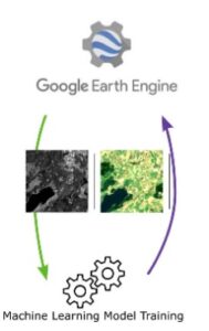
What makes this platform so impactful is its ability to link data with specific locations. As a result, it transforms raw numbers into interactive maps and layered visualizations. GIS is already being used across public health, conservation, disaster response, and agriculture. Furthermore, when combined with machine learning, GEE allows for advanced tasks such as land use classification, ecosystem forecasting, and climate impact analysis.
Given these trends, demand is growing for professionals who can work with geospatial data. This course is your opportunity to build those skills and apply them with confidence.
What will you learn
This course builds on your foundational knowledge of GEE and explores advanced techniques in vegetation analysis and machine learning. Through guided exercises and real-world datasets, you’ll gain both theoretical insight and hands-on experience.
To begin with, you’ll work with vegetation indices like NDVI, NDRE, EVI, and MCARI. You’ll apply them to real use cases in agriculture, forestry, and urban planning. In addition, you’ll write and optimize JavaScript code to efficiently process large-scale satellite data.
As the course progresses, you’ll explore supervised and unsupervised machine learning techniques. You’ll use these to classify land cover, detect changes over time, and uncover environmental trends. Moreover, you’ll interpret results using zonal statistics, maps, and graphs. You’ll also evaluate model accuracy using tools such as confusion matrices — ensuring your analysis is both valid and reliable.
Why choose this course
We don’t just teach software—we help you build practical, future-ready skills that you can apply right away. This course is built for learners who want to go beyond the basics and explore the full potential of Google Earth Engine.
Here’s what makes our course stand out:
- Expert instructors with real-world experience in GIS, remote sensing, and GEE
A hands-on approach that emphasizes doing, not just watching
- Career-focused learning designed for professionals in environmental monitoring, urban planning, and data science
- Access to real-world case studies that help you apply what you learn in a meaningful way