• Searching...

Result 37 - 48 of 59 courses

PostGIS and PostgreSQL

Databases
  • Certified
  • 3 days

PostgreSQL and Python

Python
  • Certified
  • 1 day

Python Advanced

Python
  • Certified
  • 4 days

Python and Arduino

Python
  • Certified
  • 2 days

Python and Data Science

Python
  • Certified
  • 4 days

Python Basics

Python
  • Certified
  • 3 days

Python GeoSpatial

Python
  • Certified
  • 2 days

Python Tkinter

Python
  • Certified
  • 2 days

QGIS 3D Visualization

All of QGIS
  • Certified
  • 1 day

QGIS Advanced

All of QGIS
  • Certified
  • 2 days

QGIS and Blender

All of QGIS
  • Certified
  • 2 days

QGIS and Geoserver

All of QGIS
  • Certified
  • 1 day

Why choose a course at Geo-ICT Training Center, The Netherlands?

55

Courses

82

Blended Learnings

1200

Participants per year

  • All courses are conducted in Virtual Classrooms.
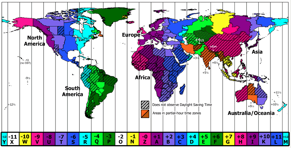
  • Our courses typically follow the Dutch time zone, with sessions from 9:00 AM to 12:00 PM and 1:00 PM to 4:00 PM. However, for participants in other time zones, we adjust the course timings based on mutual agreement.
  • The course includes various exercises, allowing you to apply what you’ve learned.
  • After completing the course, you’ll receive a participation certificate, available for download upon submitting your evaluation form.

Geo-ICT Training Center, The Netherlands - Participants in various Time Zones


Frequently Asked Questions about PostGIS and PostgreSQL

In the PostGIS and PostgreSQL course, you will learn how to set up a PostgreSQL database and store geographical data, covering topics such as using pgAdmin, loading shapefiles and CSV files, and creating spatial queries.

Yes, the course is accessible for beginners, but also provides value for experienced professionals looking to expand their knowledge.

You will learn to perform spatial queries, filter, present, and combine data, which is essential for effective data management.

PostGIS distinguishes itself from other database systems like Oracle Spatial through its open-source nature, flexibility, and cost-effectiveness. While Oracle Spatial is a proprietary system, PostGIS is free to use and highly customizable, allowing for more accessible geospatial database management. Additionally, PostGIS integrates seamlessly with other open-source tools like QGIS, making it popular among organizations seeking affordable, scalable, and interoperable solutions for spatial data management.