
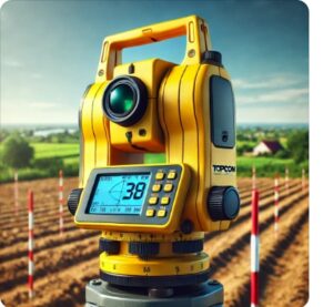
In surveying, several methods are used to measure elevation differences. In this course on digital leveling, participants will practice using both analog and digital instruments.
Geodesie
In surveying, several methods are used to measure elevation differences. In this course on digital leveling, participants will practice using both analog and digital instruments.
 Surveying, a field that embraces both traditional and modern techniques, is essential for the accurate determination of geographic and spatial data. Geo-ICT’s “Digital Leveling” course bridges the gap between these two worlds. Here, you’ll learn not only about the use of traditional instruments but also how digital technologies such as GPS and laser scanning improve the efficiency and accuracy of measurements. Key aspects of this course include:
This course emphasizes the value of both traditional methods and the integration of new technologies for capturing geodata. Through a blend of theory and practice, Geo-ICT offers an in-depth learning experience that prepares students for today’s challenges in the world of surveying.
The measurements are processed in MOVE3. With the trial version of MOVE3, the measurements can be calculated with the push of a button.
Leveling plays a crucial role in various fields where measurement accuracy is essential. This technique is not only applied in surveying but also finds its way into civil engineering, archaeology, and soil investigation. Each of these fields requires precision down to the centimeter or even millimeter, which underscores the relevance of both traditional and modern leveling methods. Below is an overview of the application areas:
The course at Geo-ICT offers a comprehensive introduction to these techniques, adapted to modern requirements for precision and efficiency. By integrating both analog and digital instruments, Geo-ICT prepares students for challenges in these and other fields.
Leveling is a fundamental technique in surveying used to determine elevation differences between points on the Earth’s surface. This technique, essential for accurate measurements, is based on several basic theories:
These principles ensure precision in various applications, from construction projects to agricultural planning. By combining traditional techniques with modern digital instruments, surveyors today can perform measurements with unparalleled accuracy.
Mastering both analog and digital leveling instruments is an essential skill in surveying. In the course offered by Geo-ICT, participants gain hands-on experience with both types of instruments. This includes:
These skills enable surveyors to perform accurate measurements in various environments and under diverse conditions.
The Dutch reference network of elevation benchmarks is crucial for surveying within the Netherlands. This network provides a standardized basis for elevation measurements, essential for:
By working with this reference network, surveyors and professionals in related fields can be assured of the precision and reliability of their measurements.
Continuous leveling is a technique used to measure elevation differences between various points over long distances. This method is essential for ensuring accuracy in projects such as road construction, land development, and water management. Key aspects for minimizing errors during leveling include:
Mastering these techniques and applying error prevention are crucial for obtaining reliable results. For practical training and further in-depth study of these methods, the Geo-ICT course offers thorough preparation.
Choosing the Digital Leveling course at Geo-ICT is not only a choice for quality and expertise, but also for a future in a field where precision is key. This course stands out because of:

Need help?
Contact usThe day begins with a presentation on the theory of leveling and the Dutch reference network of elevation benchmarks. After a brief explanation of the practical aspects of leveling, participants head outside to complete various exercises designed to help them master the technique. Once the measurements have been taken, the participants enter them into MOVE3.
Do you have questions about the course content? Or are you unsure whether the course aligns with your learning goals or preferences? Would you prefer an in-house or private course? We’d be happy to help.
In de cursus Landmeetkundig Waterpassen leer je de basisprincipes en technieken van waterpassen, essentieel voor nauwkeurige landmetingen in de geosector.
Deze cursus is ideaal voor startende geo-specialisten, ervaren geo-professionals, omscholers en medewerkers van bedrijven in de geosector die hun vaardigheden in landmeting willen ontwikkelen.
De cursus “Landmeetkundig Waterpassen” duurt één dag en kost €650 exclusief btw.
Ja, na succesvolle afronding van de cursus ontvang je een gecertificeerd bewijs van deelname.
Voor deze cursus is basiskennis van landmeetkunde aanbevolen, maar niet verplicht. Neem contact op voor meer informatie over instapniveaus.
Absoluut, deze cursus kan gecombineerd worden met andere cursussen en traineeships die wij aanbieden voor een uitgebreide leerervaring.
Ja, wij bieden nazorg en ondersteuning om ervoor te zorgen dat je het geleerde effectief in de praktijk kunt brengen.
Inschrijven kan direct via de inschrijf widget (rechterkant desktop en mobiel bovenaan).