What is surveying?
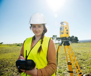
Surveying involves the precise determination and recording of positions, distances, and elevations. Surveying measurements form the basis for reliable geoinformation and are used in fields such as construction, infrastructure, land development, public space management, and the Land Registry.
During this Blended Learning course, you’ll learn the theory behind surveying. You’ll be introduced to various surveying methods and learn how instruments such as GNSS/GPS, total stations, and leveling equipment are used to determine positions and elevations.
The emphasis is on understanding how surveying works. During this Blended Learning course, you will not go out into the field with the surveying instruments yourself. However, you will work with survey data and use QGIS to view and process survey points, coordinates, and other geodata.
Coordinates, Elevations, and Reference Systems
A measured position only becomes meaningful once it is clear within which coordinate and reference system it has been recorded. That is why you will be introduced to geographic and projected coordinates, X, Y, and Z coordinates, and the use of coordinate systems in surveying.
You’ll learn the basics of how systems such as RD, ETRS89, and WGS84 are used and become familiar with NAP for recording elevations in the Netherlands. You’ll also learn why data from different reference systems cannot simply be combined.
In QGIS, you’ll examine measurement points and coordinates and explore how the Coordinate Reference System used affects the location of geodata. This module also serves as preparation for the in-depth Blended Learning course on Coordinate Reference Systems and Spatial Data.
Surveying with GNSS/GPS
GNSS is a key technology in modern surveying. You’ll learn how satellite systems are used to determine positions on Earth and become familiar with systems such as GPS and Galileo.
You’ll learn which factors influence the accuracy of GNSS measurements and become familiar with correction methods and RTK. You’ll also gain an understanding of why the accuracy of a standard GNSS position differs from the accuracy achievable in professional surveying applications.
During this Blended Learning course, we focus primarily on the theory. If you want to learn how to actually take measurements outdoors using professional GNSS/GPS equipment, you can then take the GPS Basics course.
Surveying with a Total Station
A Total Station combines the measurement of directions, angles, and distances, making it possible to survey and stake out points with high precision.
You’ll learn the key principles behind surveying with a Total Station. Topics such as station setup, orientation, directions, distances, coordinates, measurement, and staking out will be covered. This will help you understand how observations made with a Total Station are ultimately converted into coordinates.
If you want to put this knowledge into practice and actually learn how to measure with a Total Station, you can then take the Total Station Basics course.
Determining Elevations and Leveling
In addition to horizontal positions, elevations are an important part of surveying. You’ll learn how elevation differences are determined and how leveling is used to transfer accurate elevation information between different points.
You’ll be introduced to the principle of geometric leveling, forward and reverse readings, elevation differences, and checks during a leveling survey. We’ll also explain the relationship to NAP and the use of elevation data in surveying and Geo-ICT applications.
Accuracy, Measurement Errors, and Geodetic Adjustment
No geodetic measurement is completely exact. Every measurement contains uncertainties and minor deviations. That is why it is important not only to learn how to measure, but also to understand how the quality of measurements is assessed.
You will be introduced to concepts such as accuracy, precision, reliability, measurement errors, and redundant observations. You will learn why surveyors perform checks and why a point is often measured in multiple ways or multiple times.
You will also be introduced to the principle of geodetic adjustment. In this process, different observations are combined mathematically and statistically to arrive at the most reliable coordinates possible. This section serves as an introduction to the theory that is further explored in the Blended Learning course on Geodetic Adjustment.
From Surveying to Geodata in QGIS
A surveying measurement does not end at the measuring instrument. The collected coordinates and attributes must be processed into geodata that can be used within other Geo-ICT applications.
You’ll learn how to import and view survey points and their associated data in QGIS. You’ll verify coordinates, view the location of points on a map, and combine surveying data with other geographic datasets.
This will give you insight into the entire process, from field surveying to usable geoinformation in a GIS.
Surveying in Practice
During this Blended Learning course, you’ll work with examples and assignments that teach you how to apply the theoretical principles of surveying. You won’t be conducting actual field surveys yet, but you will learn to analyze surveying problems and to evaluate and process survey data.
You’ll work on assignments such as:
- Determine which surveying method is suitable for various practical situations.
- Analyze coordinates and determine the reference system in which they are defined.
- Investigate which factors influence the accuracy of a GNSS measurement.
- Analyze a simple total station measurement and determine how observations are converted into coordinates.
- Calculate and verify elevation differences from a leveling survey.
- Import survey control points into QGIS and verify their locations and associated data.
- Evaluate a series of observations for accuracy and become familiar with the principle of geodetic adjustment.
By the end of the course, you’ll have a broad theoretical foundation in surveying. You’ll understand how positions and elevations are determined, how GNSS/GPS, total stations, and levels work, and the role that coordinate systems, accuracy, and geodetic adjustment play in these processes. In addition, you’ll be able to view and process surveying data in QGIS.
Would you like to put this theoretical foundation into practice and actually learn how to take measurements? Then you can continue with the practical “GPS Basics” course and the “Total Station Basics” course, in which you’ll take measurements yourself using professional surveying equipment under the guidance of an instructor.


