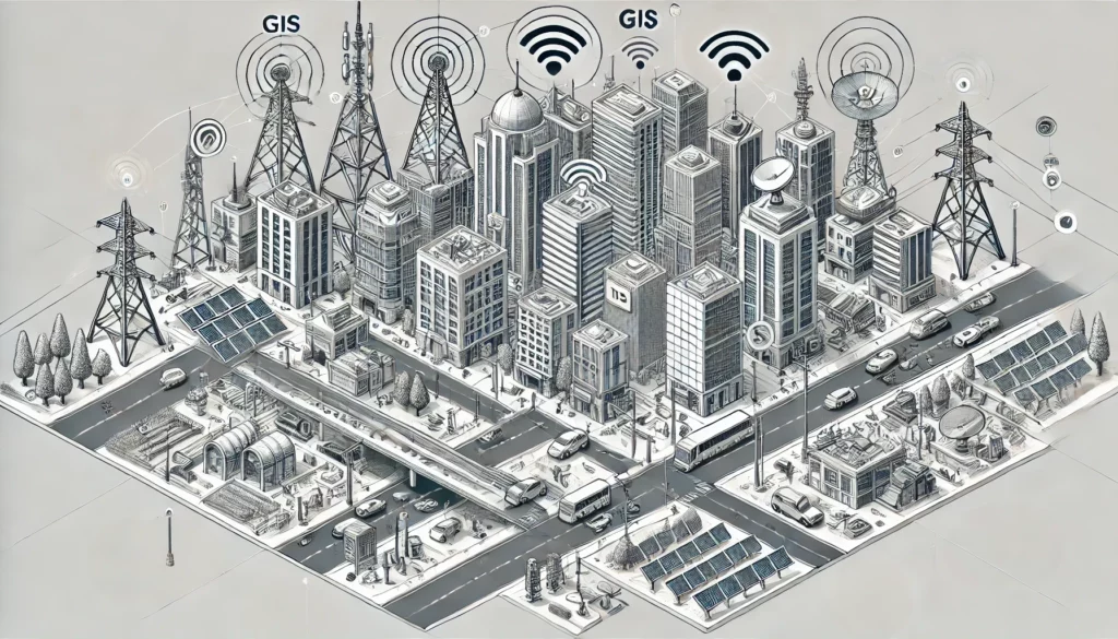
GIS stands for Geographic Information Systems. These are powerful tools that enable the collection, management, and analysis of geographic data. They combine various types of data to create maps and visualizations that reveal complex geographic patterns and relationships. GIS technology is widely used in sectors such as urban planning, environmental management, transportation, and marketing to solve problems and make more informed decisions.
Geographic Information Systems (GIS) are essential tools for collecting, managing, and analyzing geographic data. These systems combine various types of data to create maps and other visualizations that reveal complex geographic patterns and relationships. GIS technology is used across various sectors to solve problems and support decision-making, ranging from urban planning and environmental management to transportation and marketing.
The power of GIS lies in its ability to integrate and analyze data from multiple sources, providing users with insights into spatial relationships and trends. This enables monitoring changes over time, determining optimal locations, and evaluating the impact of various factors on specific areas.
Thus, GIS is not only a technical tool but a powerful instrument that contributes to a better understanding of our world.
A Geographic Information System (GIS) is a system designed to collect, manage, analyze, and display geographic data. It combines location information (where things are) with descriptive information (what these things are). This allows users to understand patterns, relationships, and geographic context. GIS is used in nearly every industry to create maps, perform analyses, share information, and solve complex problems.
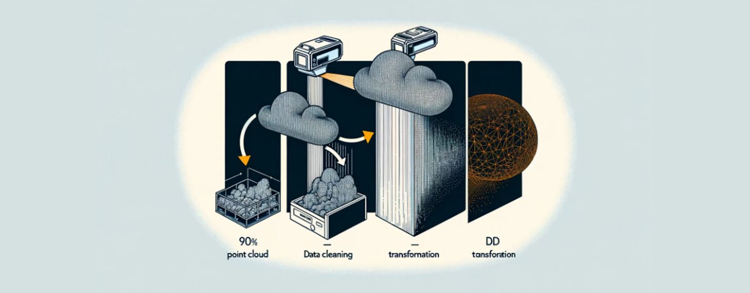
GIS consists of several components, including hardware, software, data, people, methods, and procedures. It can integrate data from various sources, such as satellite imagery, tables, and maps. By layering this data onto a single map, users can better understand and visualize spatial relationships and trends.
For example, GIS can be used to identify which houses are in flood-prone areas, map the spread of diseases, or analyze the impact of urban development on the environment.
GIS helps users make better-informed decisions by enabling them to present data in a visually understandable way.
The importance of Geographic Information Systems (GIS) cannot be overstated. GIS has fundamentally changed the way we understand and analyze the world around us. Here are some of the key benefits and applications of GIS:
Through the power of GIS, organizations can not only visualize complex data but also gain deeper insights that would otherwise be difficult to uncover. Whether predicting the impact of new developments or managing resources, GIS provides a valuable tool for improving our world.
One of the greatest advantages of Geographic Information Systems (GIS) is the efficiency it offers in data management. GIS enables the collection, storage, management, and analysis of vast amounts of spatial data in a highly structured and organized manner.
GIS thus plays a crucial role in improving data management efficiency. This leads to better performance, lower costs, and more informed decision-making across various sectors.
Geographic Information Systems (GIS) have a wide range of applications across different sectors, highlighting their versatility and value. Here are some of the most prominent practical applications of GIS:

These applications demonstrate how GIS helps solve complex problems by providing detailed spatial analysis and visualizations, resulting in better-informed decision-making and more efficient management across various sectors.
The future of Geographic Information Systems (GIS) is promising, thanks to several innovative developments:
These trends make GIS an essential tool for future urban and environmental management.
GIS plays a crucial role in various sectors, from urban planning to environmental management. Choosing the right GIS software can make a significant difference in the efficiency and effectiveness of your projects. Here, we discuss two of the most popular GIS packages: ArcGIS and QGIS.
ArcGIS is a leading GIS software suite developed by Esri. It is widely used around the world for collecting, analyzing, and visualizing geographic data. With ArcGIS, you can perform complex spatial analyses, create maps, and manage geographic data. It offers extensive functionalities, including 3D visualization, geoprocessing, and real-time data analysis.
A key feature of ArcGIS is its ability to integrate data from various sources and present it in an understandable way. This makes it a powerful tool for decision-makers in various sectors such as urban planning, environmental management, and transportation. ArcGIS helps identify patterns and trends, leading to better-informed decisions and more efficient resource management.
Although ArcGIS is highly versatile and powerful, it is also paid software. This means users must purchase a license to access the full range of features and support offered by Esri. This investment is often worth it given the capabilities ArcGIS offers for professional and accurate geographic analysis.
QGIS is a popular, free, and open-source GIS software used by professionals and hobbyists worldwide. It is designed to provide users with powerful tools for creating, editing, visualizing, and analyzing geospatial data. QGIS supports a wide range of operating systems, including Windows, macOS, and Linux, and offers extensive features comparable to commercial GIS software.
One of the biggest advantages of QGIS is its active community that contributes to the continuous development and improvement of the software. This community regularly develops new plugins and add-ons, further extending the functionality of QGIS and making it adaptable to user needs.
QGIS is ideal for anyone seeking a cost-effective solution for geospatial analysis without compromising on functionality.
Geographic Information Systems (GIS) are essential for collecting, managing, and analyzing geographic data. They provide valuable insights and support better-informed decisions across various sectors, such as urban planning, environmental management, and transportation. GIS enhances efficiency in data management and helps visualize complex spatial relationships. With ongoing technological advancements, GIS remains a crucial tool for understanding and improving our world. Interested in working with GIS? Check out our GIS traineeship, your gateway to the world of Geo-ICT!