What will you learn
You’ll start by learning how PostgreSQL works as a relational database and why it’s an ideal platform for managing both attribute and geographic data. Then you’ll dive into PostGIS, where you’ll explore how to store, analyze, and visualize spatial data efficiently.
Throughout the course, you’ll build your own spatial database from the ground up. You’ll import shapefiles, CSVs, and other geospatial data formats, and learn how to structure and manage your data properly. Using SQL, you’ll perform location-based queries such as proximity searches, containment checks, and spatial joins.
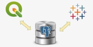
You’ll also learn how to connect your database to QGIS, enabling you to create maps and visualizations from the data you manage. By integrating PostgreSQL, PostGIS, and QGIS, you’ll build a complete, end-to-end GIS workflow—ready to be applied in real-world projects like planning, environmental monitoring, or logistics optimization.
Why choose this course
If you’re ready to advance your skills in spatial data management, this course offers the perfect combination of theory, hands-on experience, and real-world application. Here’s why students choose Geo-ICT:
- Expert instruction: Learn from professionals who apply these tools daily in GIS and spatial database projects.
- Practice-focused learning: Build and use your own working spatial database through guided exercises and challenges.
- Tool proficiency: Gain experience with PostgreSQL, PostGIS, and QGIS—industry-standard open-source technologies.
- Career relevance: These skills are in demand across sectors including government, environmental science, infrastructure, and tech.