Turn geospatial data into actionable insights using the power of spatial data science. In this practical, hands-on course, you’ll learn how to analyze patterns, build predictive models, and uncover meaningful relationships in location-based data — all using QGIS, a powerful open-source GIS platform. From geostatistics to machine learning, this course equips you with the tools to solve real-world challenges in environmental management, urban planning, and beyond.
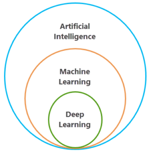
Spatial data science sits at the intersection of geographic information systems (GIS) and modern data analytics. It combines techniques such as geostatistics, spatial modeling, and machine learning to extract insights from data tied to specific locations. Unlike traditional data analysis, which often ignores spatial context, spatial data science introduces a crucial dimension: understanding where things happen — and why it matters.
This approach has never been more relevant. In fact, nearly every major challenge today involves location-based decisions. From climate resilience and public health to infrastructure planning and logistics, spatial data science helps address them more effectively. By analyzing spatial patterns, organizations can detect trends, predict outcomes, and make smarter, faster, and more strategic decisions.
For example, urban planners use spatial analysis to reduce traffic and optimize development. Similarly, environmental scientists monitor deforestation and assess flood risk. Emergency responders depend on it for resource planning, while businesses apply it to improve delivery logistics and market targeting.
QGIS plays a central role in enabling this work. As a flexible, open-source GIS platform, it allows professionals to handle large spatial datasets, develop predictive models, and present results clearly — without the high costs of proprietary software. Moreover, with its robust plugins and built-in tools, QGIS supports the full spatial data science workflow: from data cleaning and analysis to visualization and reporting.
Whether you’re a GIS analyst, planner, researcher, or just getting started in geospatial work, spatial data science gives you a smarter way to understand and act on location-based data. And QGIS gives you the freedom and flexibility to do it your way.
What will you learn
This course offers a complete introduction to spatial data science using QGIS, with a strong focus on real-world, hands-on experience. You’ll dive into advanced analytical techniques such as spatial interpolation, clustering, geostatistics, and machine learning — all within the QGIS platform.
As you progress, you’ll build predictive models, uncover trends in spatial datasets, and develop the skills to apply these insights to meaningful decisions. You’ll also sharpen your ability to communicate results through clear, effective maps and visualizations that bring your findings to life.
Working with real datasets and guided case studies, you’ll build confidence in solving complex spatial challenges. By the end of the course, you won’t just know the tools — you’ll know how to use them in a practical, applied way.
Why choose this course
At Geo-ICT, we believe data science should be hands-on, accessible, and immediately useful. That’s why this course blends expert instruction with real-world practice — so you can start applying your skills from day one.
Here’s why professionals choose this course:
Expert guidance from instructors who work with spatial data science every day
Practice-first learning through projects and exercises based on real challenges
Focus on QGIS, so you can work with a powerful open-source platform used across the globe
Adaptable to your experience level, whether you’re a beginner or expanding your skill set
This course is designed for anyone who wants to do more with location data — and turn spatial information into smart, data-driven decisions.
The first day begins with a deep dive into the fundamentals of spatial data science and QGIS. You’ll explore concepts like spatial variability, kriging, and point pattern analysis, using geostatistical techniques to understand how data varies across space.
In the afternoon, the focus shifts to data science methods. You’ll get hands-on with clustering, classification, and regression, using QGIS to analyze patterns and develop spatial models that support real-world decisions.
Day 2
On day two, you’ll advance into more complex analysis techniques. You’ll explore decision trees, spatial regression, and model evaluation — learning when and how to apply different methods based on the type of data and problem at hand.
The day finishes with a focus on communication. You’ll learn how to design maps and visualizations that make your results easy to understand and impactful to share. You’ll wrap up by applying what you’ve learned in a final case study that mirrors the kinds of challenges you’ll encounter in practice.
Understand the key principles of spatial data science, including geostatistics, spatial modeling, and machine learning
Apply advanced spatial analysis techniques such as interpolation, clustering, and regression using QGIS
Build and evaluate predictive models to support evidence-based decisions
Process and visualize geospatial data to uncover patterns, trends, and relationships
Communicate spatial insights through clear, impactful maps and visual storytelling
More Information?
Do you have questions about the course content? Not sure if the course aligns with your learning objectives? Or would you prefer a private session or in-company training? We’re happy to assist—feel free to get in touch.
Frequently Asked Questions about Spatial Data Science with QGIS
In this course, you will learn how to work with spatial data using QGIS, including data processing, spatial analyses, and creating clear visualizations for geospatial insights.
Basic familiarity with QGIS is helpful, but not required. The course is accessible to beginners and also offers depth for those with some experience in geospatial tools.
Geospatial analytics with QGIS enables you to explore spatial relationships and trends, supporting better decision-making in urban planning, environmental management, infrastructure, and more.
Spatial data analysis focuses on the location-based aspects of data, allowing you to explore patterns and relationships that are tied to geography—something general data analysis doesn’t cover.
You will learn to manage and manipulate geospatial datasets, perform spatial queries and analyses, and create professional maps to communicate your findings.
This course focuses on foundational spatial data techniques in QGIS. While machine learning is not a core component, you’ll gain analytical skills that provide a strong basis for more advanced workflows.
Yes, upon completing the course, you’ll be equipped to handle your own spatial data projects confidently using QGIS.
Effective map design is a key part of the course. You’ll learn how to visualize your data clearly and professionally to support communication and storytelling.