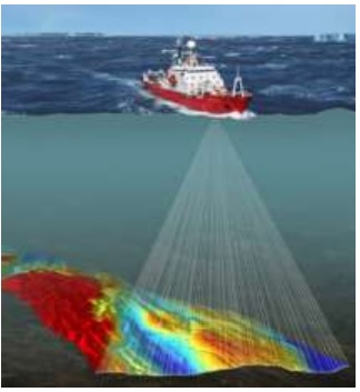
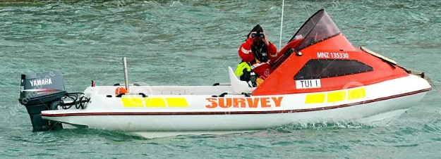
In hydrography—the science of measuring and mapping underwater environments—precision is everything. Whether it’s for maritime safety, offshore construction, environmental research, or coastal planning, understanding the seafloor is essential. As a result, multi-beam survey technology has become the go-to method for capturing high-resolution, 3D images of seabeds, riverbeds, and lakebeds.
Unlike single-beam sonar, which scans a narrow line beneath the vessel, multi-beam systems use hundreds of sound beams at once. This allows surveyors to capture wide, detailed swaths of data in a single pass. Consequently, they can measure depth, identify underwater features, and build detailed digital maps. The data is essential for nautical chart creation, seafloor condition assessments, and even the discovery of archaeological sites and shipwrecks.
As climate change, coastal development, and marine exploration accelerate, so does the need for professionals skilled in hydrographic data collection and analysis. Today, environmental agencies, offshore companies, research institutions, and government bodies all rely on experts who understand both the theory behind sonar systems and the technical know-how to operate them in real-world conditions. For that reason, this course was designed to give you the practical and technical skills needed to succeed in this growing industry.
What will you learn
This course provides a complete introduction to the tools, workflows, and techniques used in multi-beam hydrography. To begin with, you’ll learn how to operate a multi-beam echosounder system, manage onboard calibrations, and maintain data quality from start to finish. In addition, you’ll gain experience planning surveys and producing accurate bathymetric maps.
Along the way, you’ll also discover how positioning systems, motion sensors, and specialized software integrate into a reliable workflow for marine data collection. By the end, you’ll understand not just how the tools work — but how to apply them effectively in field operations.
Why choose this course
At Geo-ICT, we don’t just teach tools — we help you build practical, job-ready skills. From day one, you’ll train with real equipment, gain hands-on experience, and work through scenarios that mirror real-world hydrographic projects.
Here’s what makes this course stand out:
- Hands-on training with industry-standard tools, workflows, and datasets
- Expert instruction from professionals in hydrography and geospatial analysis
- Career-focused content aligned with roles in marine data, GIS, and environmental monitoring
- Access to modern technology, including multi-beam sonar and advanced processing software
In short, this course equips you with the knowledge, tools, and confidence to excel in today’s hydrographic industry.


